I've been delaying working on the rest of my pictures because I've been back to work and life
has interrupted, and I knew that this next group had a lot of pictures I needed to merge
together, and didn't think it would be easy. ... and, I was right! It's taken a fair amount of
time and a few parts can't be shown. In any case, there are a lot of pictures so I'll post what
I have in different groups.
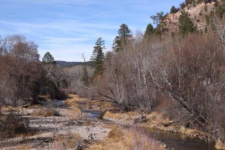
For our last major trip, we went to Silver City, which is home to lots of western legends...
one of the places where a lot of 1800's bad guys used to hang out, and north of there over the
mountains is the Gila National Wilderness Area. I thought the Adirondacks was a real
wildnerness, which it is in it's own way, but this area can be very desolate, and very remote!
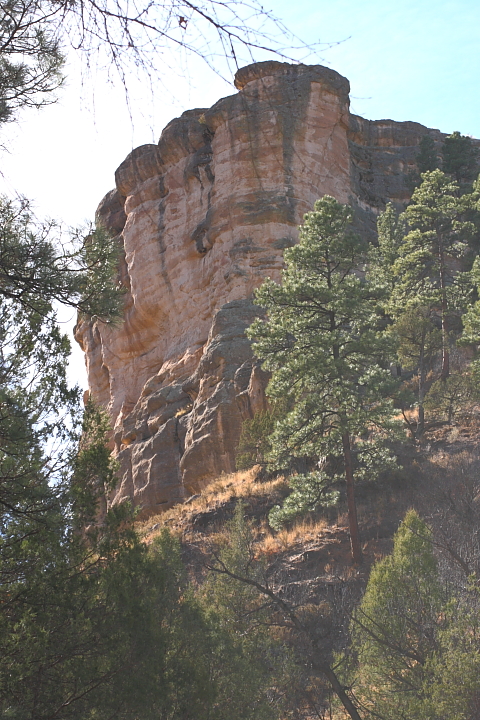
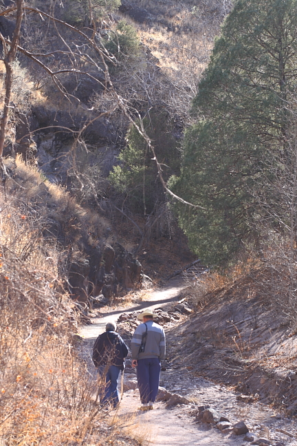
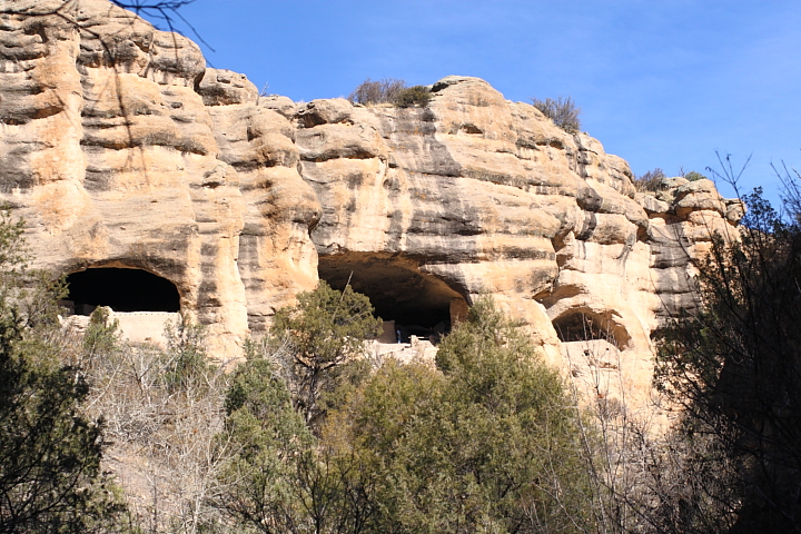
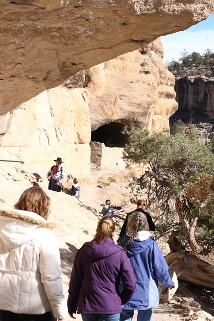
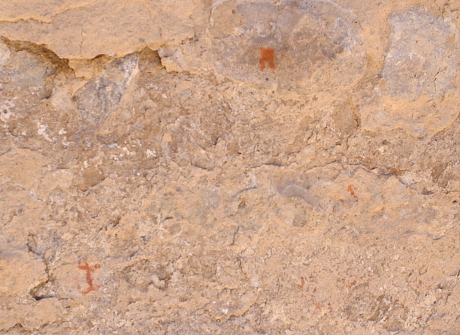
To get to the Gila Cliff Dwellings, there is one road in and out. It's amazing that these people
around 700 years ago were just wandering around this neck of the woods, and found the
caves to put their adobe houses in. We had to cross the mountains north of Silver City,
which meant a few hours of slow driving and lots of switchbacks, and rock formations
up on the side hills that you could see briefly, but often no real place to stop; and if you
happened to be driving and tried to look at something too long, you might miss a curve
and drive down a very, long, steep drop!
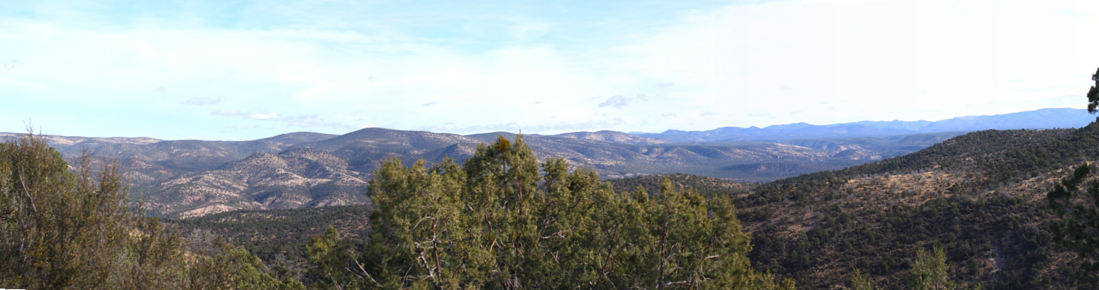
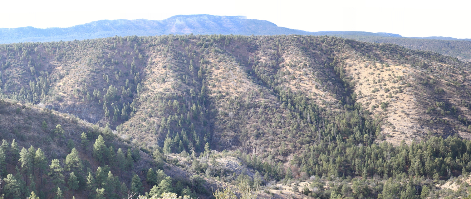
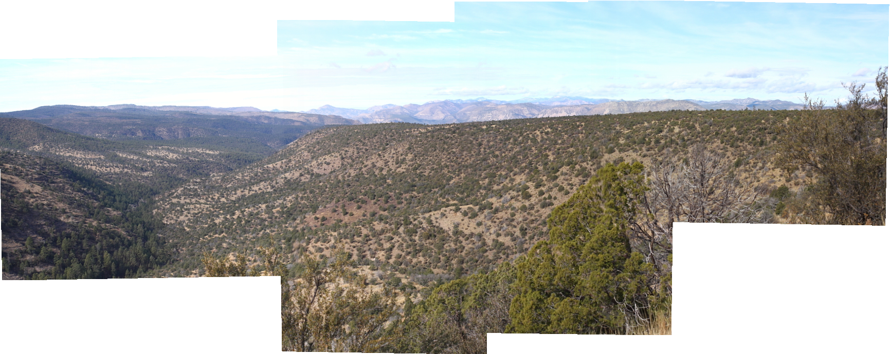
the first pictures are two merged areas in the mid-mountains starting to go down the other
side towards the Gila park area; the first image is the view to the left or south, and the
second merged grouping is a continuation just to the northwest (I couldn't get these two groups
to play well and merge together). I had more views in the deep bottoms of the valley, but
couldn't add them on properly
these pictures were taken right from the edge of the road. there were a number of parking spots
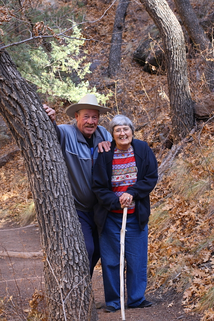
where you could pull off literally within feet of an amazing drop down into the valley! my stepfather
was joking that my mother probably wasn't too happy with his stopping there as she isn't crazy
about heights, but I have to admit; though I don't usually have a problem with heights, when we
would stop along the road and I would lean towards the side of the car with the drop, I would get
the willies a little bit that much open volume with such a steep drop is a bit intimidating!
this really was an amazing area; there are lots of things I didn't take pictures of, and after a point it
was difficult to decide what to try and take a picture of. the views were just endless and amazing,
with mountains beyond mountains and more and more valleys. a person would want to take pictures
endlessly to capture all the images, but there just was no way to do that. after a point, you just had to look and remember
has interrupted, and I knew that this next group had a lot of pictures I needed to merge
together, and didn't think it would be easy. ... and, I was right! It's taken a fair amount of
time and a few parts can't be shown. In any case, there are a lot of pictures so I'll post what
I have in different groups.
For our last major trip, we went to Silver City, which is home to lots of western legends...
one of the places where a lot of 1800's bad guys used to hang out, and north of there over the
mountains is the Gila National Wilderness Area. I thought the Adirondacks was a real
wildnerness, which it is in it's own way, but this area can be very desolate, and very remote!
To get to the Gila Cliff Dwellings, there is one road in and out. It's amazing that these people
around 700 years ago were just wandering around this neck of the woods, and found the
caves to put their adobe houses in. We had to cross the mountains north of Silver City,
which meant a few hours of slow driving and lots of switchbacks, and rock formations
up on the side hills that you could see briefly, but often no real place to stop; and if you
happened to be driving and tried to look at something too long, you might miss a curve
and drive down a very, long, steep drop!
the first pictures are two merged areas in the mid-mountains starting to go down the other
side towards the Gila park area; the first image is the view to the left or south, and the
second merged grouping is a continuation just to the northwest (I couldn't get these two groups
to play well and merge together). I had more views in the deep bottoms of the valley, but
couldn't add them on properly
these pictures were taken right from the edge of the road. there were a number of parking spots
where you could pull off literally within feet of an amazing drop down into the valley! my stepfather
was joking that my mother probably wasn't too happy with his stopping there as she isn't crazy
about heights, but I have to admit; though I don't usually have a problem with heights, when we
would stop along the road and I would lean towards the side of the car with the drop, I would get
the willies a little bit
that much open volume with such a steep drop is a bit intimidating!
this really was an amazing area; there are lots of things I didn't take pictures of, and after a point it
was difficult to decide what to try and take a picture of. the views were just endless and amazing,
with mountains beyond mountains and more and more valleys. a person would want to take pictures
endlessly to capture all the images, but there just was no way to do that. after a point, you just had to look and remember
Last edited: